Transmutable Software
Step By Step Photo Mapping: Basics
- By Trevor F. SmithStep 2: Import roads
Now that I have image files on my hard drive, I open 93 Photo Street:
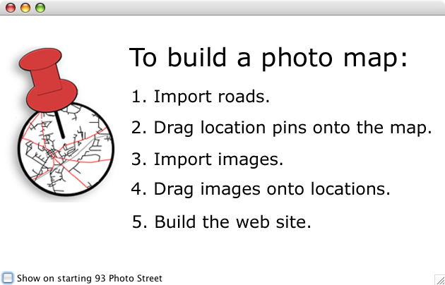
The quick start page shows the steps to take when making a photo map, so I start with step one, "Import roads."
Import roads
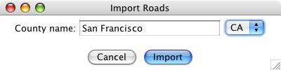
I happen to know that the city of San Francisco is in San Francisco County, so I select the "Map->Import roads..." menu item and then type that into the county name field, select CA from the state drop down menu, and click the "Import" button:
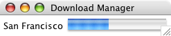
Because I haven't loaded San Francisco County before, 93 Photo Street contacts the US Census servers and downloads the free road data files:
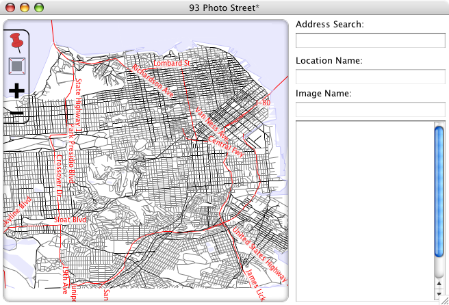
When the download completes, 93 Photo Street shows a map of all of the roads and water bodies in San Francisco County:
Note: New in 93 Photo Street Version 1.2, you can import your own map images using the "Map->Import map image..." menu item.
If I had taken photos for more than one county, I would import more roads. But since I have all of the road maps I need, I can move on to the next step.
Step 3: Drag location pins onto the map >>